
This walk explores the delightful hilly country on the Cheshire edge of the Peak District.
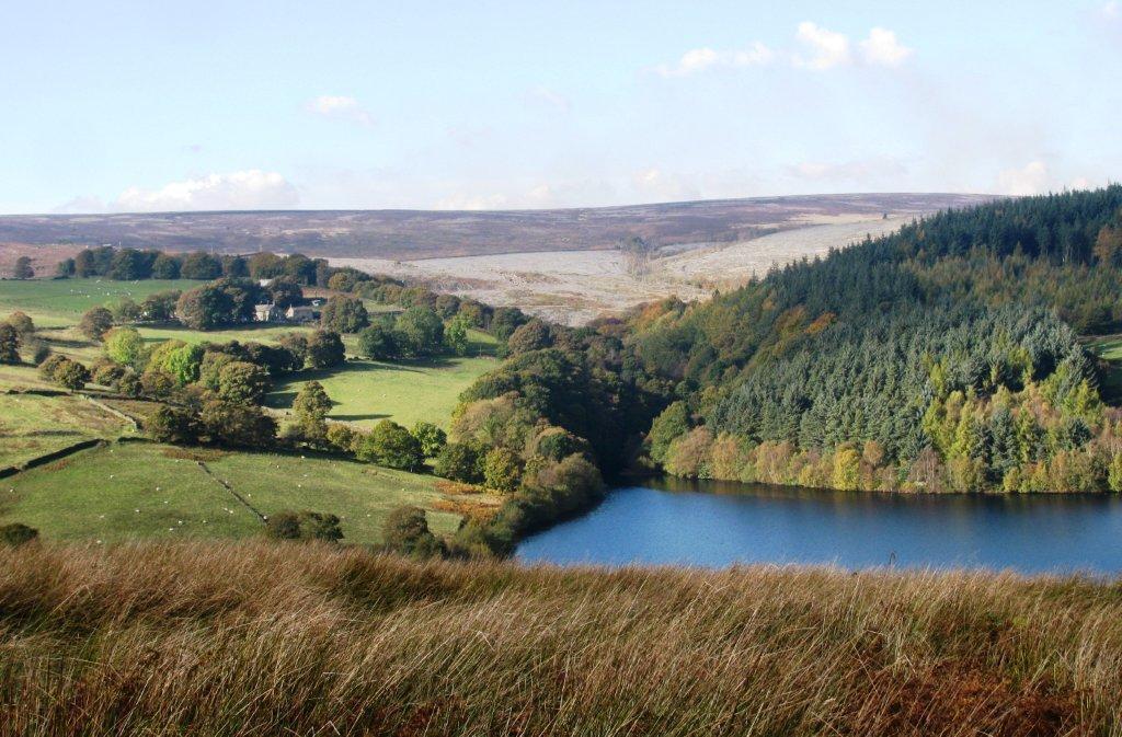
Starting at Marple Bridge, the route joins the Peak Forest Canal, built to bring limestone from Derbyshire quarries, then drops down to the River Goyt, a tributary of the River Mersey.
From here there is a climb to the secluded hamlet of Brook Bottom and a return to Marple Bridge with great views of the Goyt Valley.
The Peak Forest Canal was opened in 1800 and its towpath walk is part of the longer ‘Cheshire Ring’ Canal Walk.
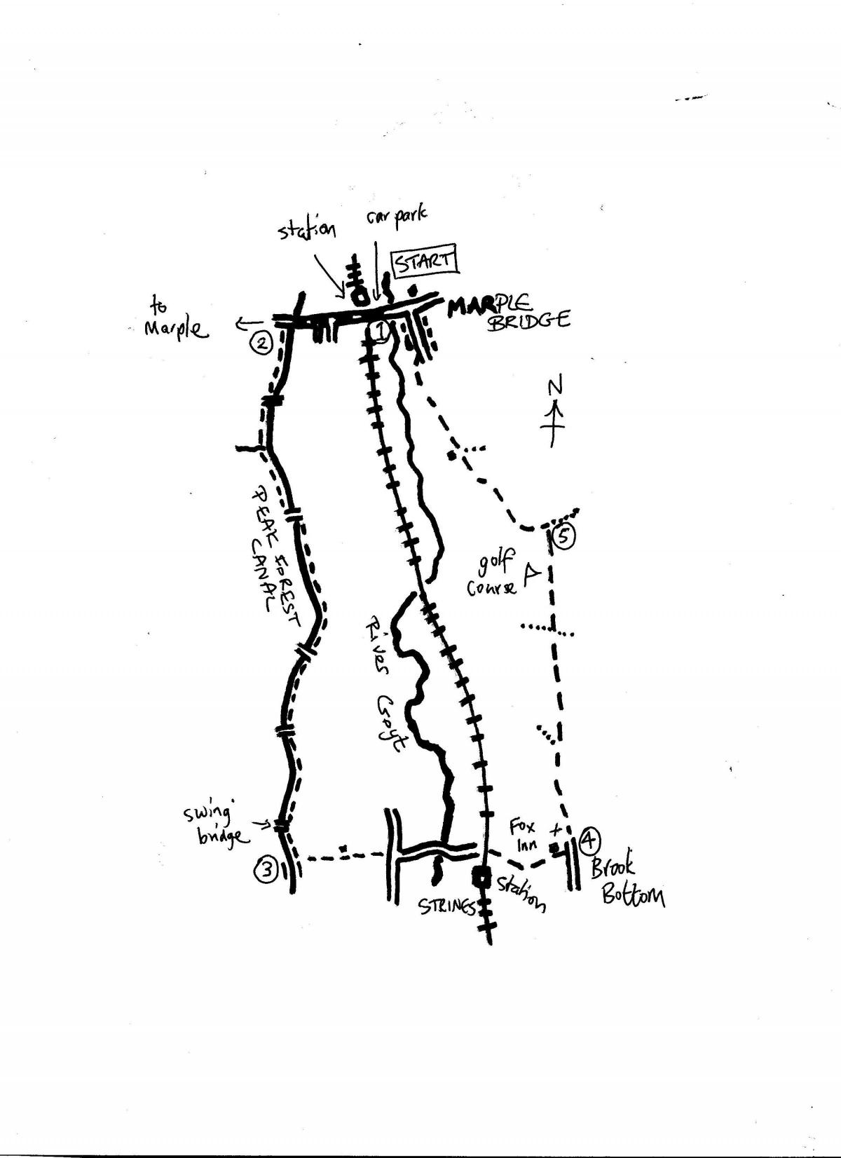
1.Turn right uphill from the train station following the left hand side of the road. Cross over the canal at the road bridge and turn left to join the towpath on the right hand side of the canal. This runs alongside a park and under a tunnel to reach a junction of canals by an information board.
2. Follow the road over canal bridge number 18 and immediately join the canal forking left, which is signed along the towpath as the Goyt Way.
Crossing over the next bridge number 19 rejoin the towpath now with the canal on the right hand side.
The towpath is now followed straight ahead for the next one-and-a-half miles going under several bridges along the way. After passing the small swing bridge leave the canal on the left approximately 200 metres beyond this bridge.
3. The path downhill begins at a step and joins a track emerging from a tunnel under the canal. Turn left and follow the lane downhill past cottages to reach the main road.
Take care crossing the road and continue downhill along the lane directly opposite. This crosses the River Goyt and climbs to Strines station.
Follow the cobbled lane under the railway to reach a junction of tracks. Take the track forking right which leads uphill through woodland.
The path climbs steeply above the valley to reach the Fox Inn in the hamlet of Brookbottom.
4. Continue along the lane to the right hand side of the pub which winds through the hamlet and passes a church. Continue along the farm lane past houses and when it forks, take the right forking higher track rather than the lane going downhill.
The higher track maintains its height, passes a crossroads of tracks, and keeps straight ahead to the driveway entrance of Mellor golf course.
5. At the driveway turn sharp left and keep to the main drive passing the entrance to Linnet Clough Scout Camp.
Go straight ahead from here along the stony track which drops gradually to woodland and an old farm, Bottoms Hall.
Go straight ahead along an access road and when it forks into two take the right fork and follow Low Lea Road. This leads back to Marple Bridge's main street. Turn left to return to the train station.
START: Marple railway station. Near to this there is a public car park at Brabyns Brow on the A626
DISTANCE: Six-and-a-half miles (allow two-three hours)
MAP: OS Explorer OL1 Dark Peak


Comments: Our rules
We want our comments to be a lively and valuable part of our community - a place where readers can debate and engage with the most important local issues. The ability to comment on our stories is a privilege, not a right, however, and that privilege may be withdrawn if it is abused or misused.
Please report any comments that break our rules.
Read the rules here