
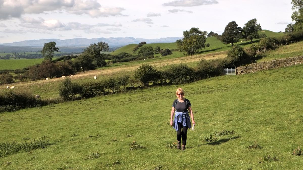
THIS short walk from The Plough at Lupton and along hilly footpaths and tracks provides commanding panoramic views of the surrounding countryside, writes JOHN EDMONDSON. Enjoy strolling through peaceful pastures, but don’t be put off by the sound of gunfire - it’s only clay shooting.
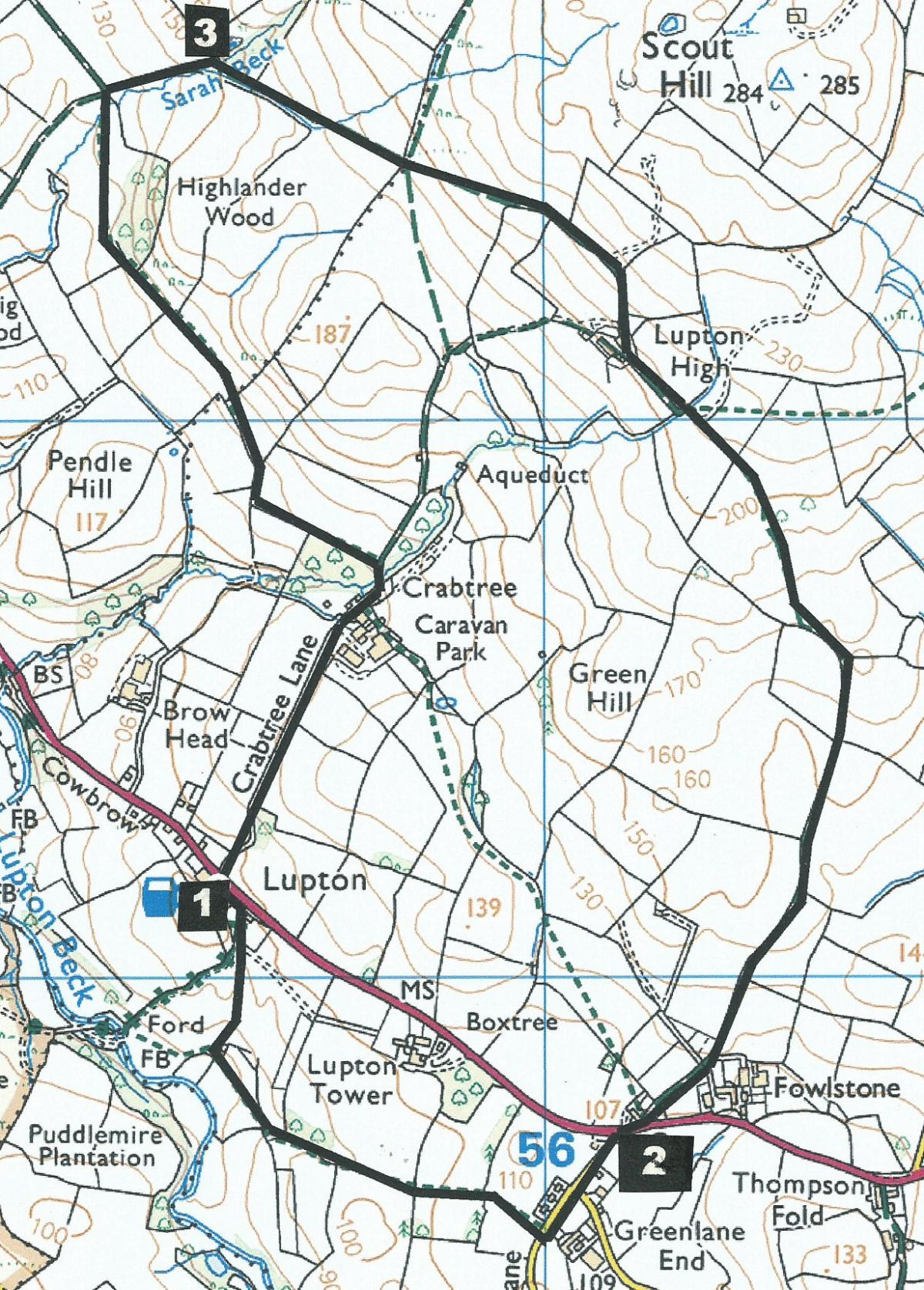
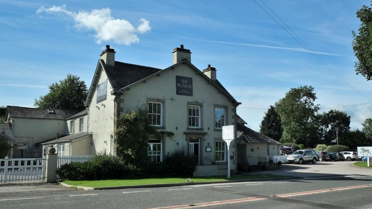
Start from The Plough at Lupton (map reference SD 554 811, postcode LA8 1PJ).
Information:
Distance: 3.7 miles, ascent: 650 feet
Time: 2 hours
Terrain: grassy field paths and farm tracks
Map: OS Explorer OL7
Route:
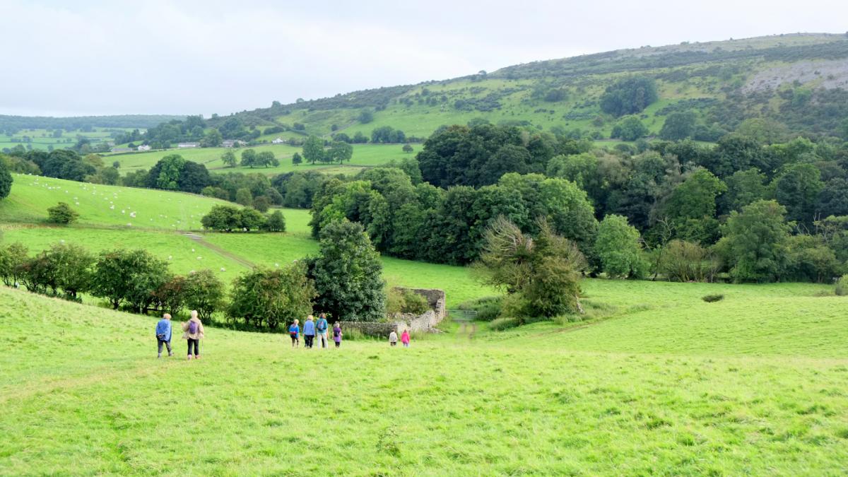
1 Set off on the footpath next to Dorothy Wightman’s Gallery, which is on the Kirkby Lonsdale side of The Plough. After a cattle grid veer to the left of the track and go down the field to a gate next to a ruined stone building. Cross the field to the top left corner and go over two fence stiles then up a slope to a kissing gate. Walk along the edge of the field, over a fence stile and along the left side of a wire fence. The fortified house on the left is Lupton Tower, an 18th Century manor house which is the head office of Witherslack Group, who provide specialist education and care for children and young people with social, emotional and mental health needs, communication difficulties and complex learning needs. Squeeze through a stile and cross a field towards farm buildings and go through another squeeze stile next to a metal drinking trough. Turn left and walk along the tarmacked lane to the A65.
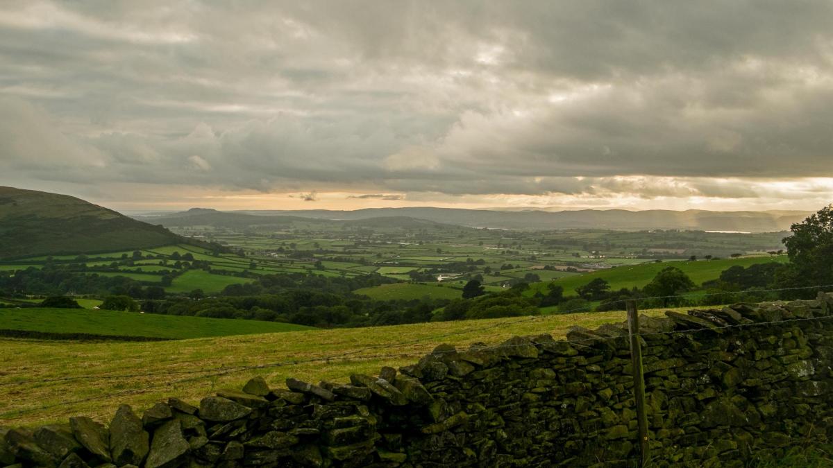
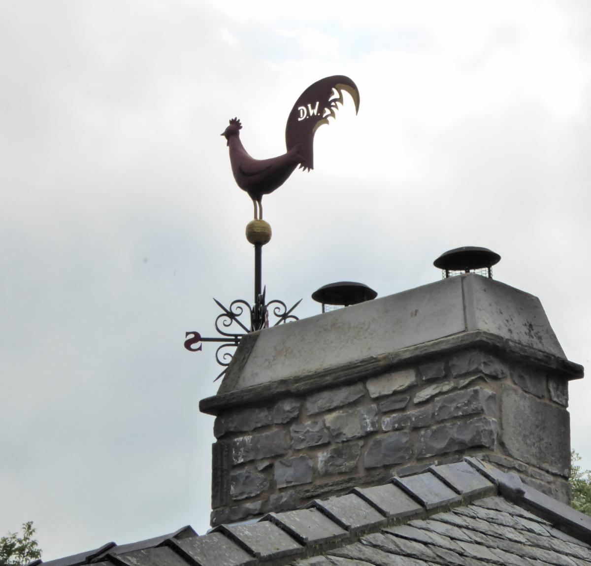
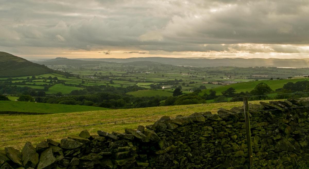
2 Cross the road with great care, turn right then after 50 yards, left after Smithy Cottage. Walk ahead up the hedged tracked signed Public Way. Continue through field gates onto the public bridleway, steadily rising onto fields. Walk alongside a hedge on the left then follow the track up the field beside a ditch. Views open out to the right of Barbon Low Fell and Gragareth and behind of Farleton Knott. After two metal field gates the track bends left and continues to Lupton High Farm. Note the weathercock on the chimney with the letters DW. After passing the farm turn right through a field gate and walk along a gorse-laden track to a gate on the left then go downhill by the side of a wall to another gate. Continue going downhill beside the wall on the right, passing gorse bushes to a wooden gate ahead. Continue to the bottom of the second field at the lower corner of a wood. After passing through this gate, note the metal gates of Thirlmere Aqueduct to the left and right where the track bends. The track goes alongside Sarah Beck.
3 At the bottom of the slope where the track bends right go straight on through a metal gate and turn left passing a footpath waymarker and cross the beck below overhanging trees. Walk below Highlander Wood to a fence stile in the diagonally opposite corner of the wood. Walk alongside a fence at the bottom of a field, over a wall stile and continue on the left of a fence to a gated squeeze stile then along the edge of the field ahead to a metal gate at the bottom right corner. Cross the field going slightly uphill to a metal field gate just above the left of the wood. Turn right onto the lane and descend to cross a bridge high above a small beck, then past a white house and Crabtree Shooting Ground. Clay shooting from here takes place in a sporting set-up, in gullies and among trees in scenic fields. Continue down the tarmacked lane to meet the A65 opposite The Plough.
NB: Restrictions on space mean that this article provides a general summary of the route. It is advisable for anyone who plans to follow the walk to take a copy of the relevant Ordnance Survey map.
Next week: Great Dodd


Comments: Our rules
We want our comments to be a lively and valuable part of our community - a place where readers can debate and engage with the most important local issues. The ability to comment on our stories is a privilege, not a right, however, and that privilege may be withdrawn if it is abused or misused.
Please report any comments that break our rules.
Read the rules here